
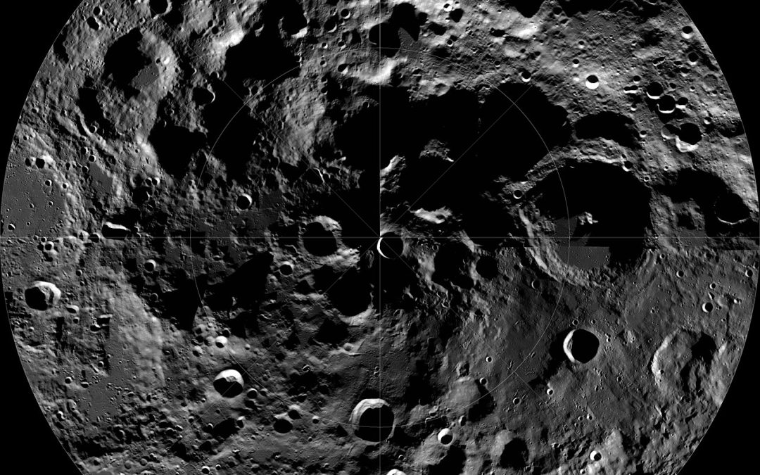

The South Pole-Aitken basin is the largest, oldest impact scar on the Moon. It stretches roughly 2,500 km across the lunar farside — about the distance from Waco, Texas, to Washington, D.C. — and it gouges more than 8 km into the crust. The basin is named for the south pole on one rim and the crater Aitken on the other. Radiometric dating of lunar meteorite Northwest Africa 2995, almost certainly ejected from the basin, puts its formation at 4.32–4.33 billion years ago, within the first few hundred million years of the Moon's existence. The collision that made it would have punched through the entire crust and into the mantle; in principle, the deepest materials exposed anywhere on the lunar surface should sit inside its rim. For most of the space age that sentence ended with "in principle," because no one had ever brought a piece of it home.
That changed on June 25, 2024, when China's Chang'e-6 mission returned 1,935.3 grams of regolith from a landing site in the southern Apollo basin, a smaller feature nested inside SPA. It is the first sample return from the lunar farside. The papers since have been working through what those 1,935 grams actually are: basalts that are distinct from every previous lunar sample, dating to about 2.83 billion years ago, with mantle-derived and impact-melt candidates both represented in the analytical queue. The mantle claim — the one that would justify SPA as a window into the deep Moon — is the headline. It is also, in the relevant literature, an open analytical question rather than a settled finding. Multiple groups are still mass-spec'ing isotopes and running through the petrologic implications.
The reason this matters as a verification story is that the substrate — what the remote-sensing instruments can actually resolve — is much narrower than the marketing layer that gets put on top of it. Three numbers do almost all the work.
1. LROC Narrow-Angle Camera (NAC). Two panchromatic line-scan cameras on NASA's Lunar Reconnaissance Orbiter, launched June 2009. 0.5 meters per pixel spatial resolution, 500-Mpixel images, ~5 km swath. NAC sees shape. It can resolve boulders, fresh crater rims, the tracks of rolling rocks, the morphology of a crater wall. It cannot tell you what the rocks are made of, beyond very broad albedo and roughness properties. NAC's role in the SPA story is structural: where the basin floor is exposed, where the basin-forming impact stripped material away, where subsequent craters re-excavated what lies beneath.
2. LROC Wide-Angle Camera (WAC). The third camera in the LROC instrument suite. 100 m/pixel in seven visible color bands, plus UV. WAC sees color at low resolution. With seven bands you can do broadband color-composite work and pick out major terrain types, but the spectral leverage is shallow — seven points across the visible do not uniquely separate pyroxene from olivine from plagioclase. WAC's job is to put NAC's sharp pictures into regional and global context.
3. Moon Mineralogy Mapper (M3). A guest instrument from NASA, flown on India's Chandrayaan-1 (launched October 2008, operational through August 2009). 70–280 m/pixel spatial resolution — comparable to WAC or worse, depending on the orbital pass — but with 85 contiguous spectral channels across the visible and near-infrared (VNIR, ~430–3,000 nm). M3 sees mineral absorption features. It can separate high-calcium pyroxene from low-calcium pyroxene from plagioclase/anorthosite from olivine, because each of those minerals has a characteristic absorption band somewhere in the VNIR that M3's 85 channels sample. M3 cannot resolve a hand-sample-scale texture; it cannot resolve the petrologic relationships between grains; it tells you which mineral class dominates a 70-meter pixel, not what those minerals are telling you about the mantle's history.
That last distinction is the live one. When a press release writes that a "new mineralogical map of the SPA basin shows the crust-mantle boundary," the map is M3-class (70–280 m/pixel, mineral-class-level spectral) and the claim is petrogenetic. The substrate supports the mineralogy; the discovery is the geological history the mineralogy is interpreted to imply. M3 can distinguish "this pixel is dominated by low-Ca pyroxene" from "this pixel is dominated by anorthosite." It cannot, by itself, tell you whether that distribution records a stratified mantle, a layer-cake cumulate sequence from the Lunar Magma Ocean, a heterogeneous impact-melt sheet from the SPA-forming event, or several of the above overlapping. The 2 km/pixel Mg# and mineral mapping done by Sun & Lucey in their 2024 paper — using M3 data re-binned onto a coarser grid to improve signal-to-noise — sharpens the mineralogical picture but inherits the same spectral-class ceiling.
The Chang'e-6 sample is the part that breaks that ceiling, because the 1,935 grams are at petrologic-texture resolution under a lab microscope. The 2024 National Science Review paper (South Pole–Aitken massive impact 4.25 billion years ago revealed by Chang'e-6 samples) used isotope geochronology on the returned soil to argue the SPA basin-forming impact happened around 4.25 billion years ago — earlier than some prior estimates, slightly later than the NWA 2995 meteorite's 4.32–4.33 Ga age, within the on-debate range for the basin's age. The 2025 Communications Earth & Environment paper (Crust–mantle architecture of the Moon's South Pole–Aitken basin from Chang'e-6 samples) uses the samples to argue for a stratified upper mantle preserved in the SPA region, with KREEP-poor (potassium/rare-earth-elements/phosphorus-poor) lower-crustal materials overlying more KREEP-bearing mantle-derived components. Both of these are the kind of petrologic argument that requires holding a grain of regolith in a microprobe — exactly what M3 cannot do and what NAC was never meant to do. The samples are the substrate that finally lets the remote-sensing maps be read as evidence rather than as pattern.
The verification gap that matters is not "is the data real" — it is, the instruments are well-calibrated and the M3 results are reproducible. The gap is "what the substrate can resolve" versus "what the substrate is being asked to show." A NAC image at 0.5 m/pixel is a structural picture, not a compositional one. An M3 image at 70–280 m/pixel is a mineral-class picture, not a petrogenetic one. A press release that turns either into "we can see the Moon's deep interior" has compressed the substrate. The interesting tension is not that the science is wrong; it is that the science is honest about its resolution and the press layer is not. The 1,935 grams that landed in a Chinese lab in June 2024 are the slowest, smallest, most expensive way to close that gap, and the only one that finishes it.
Sources
- South Pole–Aitken massive impact 4.25 billion years ago revealed by Chang'e-6 samples — *National Science Review* (2024) — primary source for the 1,935.3 g mass, the SPA basin age estimate of 4.25 Ga from CE-6 isotopes, and the SPA far-side context.
- Crust–mantle architecture of the Moon's South Pole–Aitken basin from Chang'e-6 samples — *Communications Earth & Environment* (2025) — primary source for the stratified upper-mantle argument from the CE-6 sample suite.
- Nature of the lunar far-side samples returned by the Chang'E-6 mission — *National Science Review* (2024) — early characterization of the 1,935.3 g sample suite and how it differs from prior lunar material.
- Lunar mantle composition and timing of overturn indicated by Mg# and mineralogy distributions across the South Pole-Aitken basin — Sun & Lucey, *Earth and Planetary Science Letters* (2024) — the 2 km/pixel Mg# and mineral map of SPA ejecta built from M3 data; the resolution-ceiling argument for SPA mineralogy.
- A controlled mosaic of Moon Mineralogy Mapper (M3) reflectance data in the lunar polar regions — *Icarus* (2025) — primary source for the M3 spatial resolution range of 70–280 m/pixel and the mineral absorption features (HCP, LCP, olivine, plagioclase) it can distinguish.
- LROC Narrow Angle Camera (NAC) specifications — Arizona State University / LROC — primary source for the 0.5 m/pixel NAC spatial resolution, 5 km swath, 2.5×26 km maximum image size, 700 mm effective focal length, 195 mm primary mirror.
- About the LROC camera system — Arizona State University / LROC — primary source for the dual-NAC + WAC configuration and the WAC's 100 m/pixel in seven visible color bands.
- Moon Mineralogy Mapper (M3) — NASA Jet Propulsion Laboratory — primary source for M3's flight on Chandrayaan-1 and its role as the first global lunar mineralogical mapper.
- Evidence of a 4.33 billion year age for the Moon's South Pole–Aitken basin — *Nature Astronomy* (2024) — primary source for the 4.32–4.33 Ga SPA age derived from lunar meteorite NWA 2995; the upper end of the basin-age debate.
- The Moon's Largest Basin — NASA Science — primary source for the ~2,500 km SPA diameter and the LRO-based visual of the basin.
- NASA LRO / LOLA — South Pole-Aitken Basin page — primary source for the >8 km basin depth and the framing of SPA as a window into the deepest lunar crustal materials.
- LRO WAC South Pole Mosaic — Wikimedia Commons (PD NASA) — public-domain image source for the basin visual embedded above.
